Landscape Types:
River Meadowlands
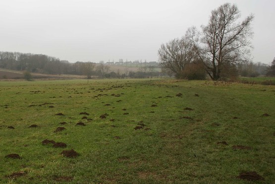
10. RIVER MEADOWLANDS
Regional Character Areas
Northamptonshire Uplands, Northamptonshire Vales, Cotswolds, Upper Thames Vale, Vale of White Horse and Vale of Aylesbury.
Location
This landscape type covers the flood plains and valley floors of the rivers Cherwell, Thames, Thame, Evenlode, Windrush, Swere and Sor Brook.
Overview
This is a linear riverine landscape with a flat, well-defined alluvial floodplain. It has pastoral character with meadows, wet and semi-improved pasture.
Key characteristics
• Flat, low-lying topography with seasonally flooded alluvial floodplains.
• Meandering river channels.
• Grazing meadows and small fields of permanent pasture.
• Riparian character with a strong pattern of riverside willows and tree-lined ditches.
• Sparsely settled with a few roads.
Geology and landform
The landscape type includes the flat, low-lying flood plains of main rivers. A thin strip of alluvium underlies the river corridors, giving rise to heavy soils with naturally impeded drainage. Many areas are still liable to flooding and are predominantly under permanent pasture. The transition between the floodplain and the surrounding landscape is subtle, with no obvious valley shape, particularly along the southern length of the River Thames where it passes through clay. In the northern part of the landscape type, there is a clear break in slope between the flat valley bottom and the steep rising valley sides.
Land use and vegetation
This landscape type is dominated by flood meadows, particularly along parts of the Upper Cherwell and Upper Thames. Small fields of permanent pasture, consisting mainly of wet and semi-improved grassland and some neutral and marshy grassland, give a sense of visual and ecological unity. This unity is interrupted in places by arable farming, particularly adjoining the river Ock and the lower Thames. Tree cover is a notable element in this landscape type, with tree-lined corridors dominated by willows, often pollarded, being characteristic throughout the landscape. White willow is more common along the upper Cherwell, the river Swere and Evenlode, with crack willow common elsewhere. Other tree and shrub species include alder, poplar, ash and hawthorn. Small deciduous plantations, frequently dominated by poplar, and small blocks of wet and semi-natural woodland also add to the tree cover along the river valleys.
Cultural pattern
The small pasture fields are enclosed by hawthorn hedges and associated ditches. In places it is the ditches, often bordered by pollarded willows, that form the main field boundaries. Hedges often include scattered ash, willow and oak trees, and this is particularly prominent along parts of the rivers Evenlode and Windrush, around Standlake. Overall, there is a strong sense of unity resulting from the extensive open views along the river corridors, except in those areas where the views are filtered by tree-lined ditches and scattered riverside and hedgerow trees.
This landscape type has historically been subject to annual flooding and this is reflected in the relative lack of settlements and buildings. The main buildings are water mills, scattered barns and farmhouses. The absence of settlements and roads generates a tranquil and remote character. There are a few settlements, including Asthall, Binsey and Wolvercote. They all retain a strong vernacular character with the possible exception of Wolvercote, where there is more recent residential development. Generally speaking, the main building materials are stone and stone tiles. The corridor of the Oxford Canal is also a strong landscape feature bordering the edge of the floodplain.
BIODIVERSITY
Overview
This landscape type includes a wide range of habitats which are typically associated with the rivers and watercourses, along with the adjacent pastures and fields of the River Thames and its tributaries.
Key Characteristics
• There is a wide range of bioscores from low to very high
• There is a large number of locally important and priority habitats particularly neutral, wet and marshy grassland bordering the rivers and watercourses.
General Description
This is a relatively large, linear landscape type, occupying around 5.5% of the rural county. It includes areas with very high bioscores including parts of the Thames upstream of Oxford, the Cherwell south of Banbury, the upper reaches of the River Windrush and the River Swere to the west of Banbury. By contrast, a number of the rivers and watercourses to the south and east of Oxford, apart from the Thames, have much lower bioscores. These include parts of the rivers Ray, Ock and Thame, and this may be linked to the fact that they traverse some of the most intensively managed areas of arable farming in the county with the resultant loss of habitat. Overall, the landscape type supports a wide range of locally important habitats including deciduous woodland, plantations, semi-improved grassland, scrub, species-poor hedges with trees and tree-lined watercourses. There are also examples of parkland, with their associated mature trees and lakes, and a little ancient semi-natural woodland. Priority habitats include flood meadows, unimproved neutral and marshy grassland. There are also species-rich ponds and lakes, reedswamp and species-rich watercourses and some species-rich hedges with trees. A significant part of the Lower Windrush Valley between Witney and the Thames at Newbridge is dominated by flooded gravel pits. Most of these are used for different types of water-based recreation, but some of the larger and least disturbed pits are notable for their bird interest, particularly overwintering wildfowl.
LOCAL CHARACTER AREAS
A. River Cherwell (north of Banbury) (NU/30)
Landscape Character
The floodplain is characterised by small fields of permanent pasture, which includes semi-improved and wet grassland and some unimproved neutral grassland. Ridge and furrow grassland can be seen to the south of Cropredy. Fields are enclosed by overgrown, gappy hawthorn hedges with hedgerow trees consisting mainly of ash, oak and white willow. In many places the hedges have been replaced by fences. A tree corridor of willows, frequently pollarded, ash and alder borders the River Cherwell. In a few places this corridor is strengthened by small, mixed and poplar plantations. The Oxford Canal has little bordering vegetation, apart from occasional trees. To the west of Chacombe, in the grounds of the Priory, there is some parkland and a moat.
Biodiversity
Bioscore/bioband: 108/MH
This area supports a range of locally important habitats including plantations, semi-improved grassland, scrub, species-poor hedges with trees and tree-lined watercourses. There is also some neutral and wet grassland along the valley bottom. The parkland area at the Priory near Chacombe has mature trees and a flooded moat.
Landscape Character
The valley bottom of the Sor Brook is characterised by small fields of permanent pasture, including wet and some semi-improved grassland, used for pony and sheep grazing. There are also a few arable fields. The fields are enclosed by intact hawthorn hedges and some scattered trees. The most prominent landscape feature is a continuous corridor of trees bordering the stream. It includes ash, willows and alder, with the willows being frequently pollarded. There are a number of small mixed plantations around Adderbury and associated with the parkland of Broughton Castle. The disused railway is also dominated by tree cover.
Biodiversity
Bioscore/bioband: 57/LM
Locally important habitats include deciduous woodland, plantations, semi-improved grassland, species-poor hedges with trees and a tree-lined watercourse. There is also some wet grassland along the valley bottom, and parkland with mature trees and a lake at Broughton Castle.
C. River Cherwell (south of Banbury) (NU/8)
Landscape Character
This area occupies the broad floodplain of the river Cherwell. Small fields are characterised by open flood meadows, marshy and wet grassland. The most prominent feature is the tree corridor of willows bordering the river. They are denser in the north, particularly around Kings Sutton, where some have been pollarded. The fields are mainly bounded by ditches, which aren’t particularly obvious except where they are lined by willows. There are also some fences and hawthorn hedges, and a few willows and poplar plantations bordering the Oxford Canal.
Biodiversity
Bioscore/bioband: 138/H
This part of the Cherwell south of Banbury has locally important habitats such as plantations, semi-improved grassland, scrub, species-poor hedges with trees and trees bordering the river. There are also areas of flood meadow, wet and marshy grassland and species-rich sections of the river and canal.
Landscape Character
The floodplain is characterised by small, geometric fields of semi-improved grassland with some flood meadow, wet, marshy and unimproved neutral grassland. Fields are enclosed by overgrown, gappy hawthorn hedges with some oak and ash trees which, in places, lie adjacent to ditches. Where they surround arable land, they tend to be a lot lower in height. The most prominent feature is the tree corridor that fringes the river and it includes willows, some pollarded, ash, alder, sycamore and the occasional oak. Trees are much denser at the western end of the corridor and it is emphasised by the small plantations of oak, ash and willow around Bloxham Bridge.
Biodiversity
Bioscore/bioband: 134/H
Along the Swere Valley there are several locally important habitats including plantations, semi-improved grassland, species-poor hedges with trees and tree-lined watercourses. There are also other important habitats including wet woodland near Deddington, and wet grassland. There are also examples of flood meadows and marsh at Barford near Bloxham, and marshy and neutral grassland in the valleys near South Newington and Hook Norton.
E. River Cherwell (Heyford Common Lock) (CW/54)
Landscape Character
The floodplain is dominated by small fields of wet and semi-improved grassland and some marshy grassland. Fields are enclosed by overgrown, gappy hawthorn hedges, ditches and occasionally fences. The most prominent landscape feature is the corridor of mature willows, ash, hawthorn and sycamore fringing both the river and Oxford Canal. The trees are more prominent and denser to the south of Upper Heyford. Pollarded willows and a few small deciduous plantations fringe ditches and small streams adjacent to the river.
Biodiversity
Bioscore/bioband: 61/M
This part of the Cherwell Valley supports locally important habitats such as deciduous plantations, semi-improved grassland, scattered scrub along the canal, species-poor hedges with trees and trees bordering the river and canal. Along the valley bottom there is also some marshy and wet grassland.
Landscape Character
The area is characterised by small regularly-shaped fields of wet and semi-improved grassland and the occasional flood meadow. A dense tree corridor of old willows, often pollarded, fringes the stream. Fields are enclosed by intact, tall hedges of hawthorn, elm and shrub willow with scattered oak and ash, and ditches. A number of small woods dominated by oak, ash and field maple lie adjacent to the river and ditches.
Biodiversity
Bioscore/bioband: 100/MH
There is only a limited range of locally important habitats in this area including deciduous woodland, semi-improved grassland, species-poor hedges with trees and tree-lined watercourse. There are also examples of flood meadow, wet grassland, wet woodland and species-rich watercourses.
G. River Evenlode (west) (CW/23)
Landscape Character
The landscape is characterised by a mix of small, semi-improved grass fields, some wet grassland, flood meadow and arable farming. Fields are enclosed by tall hawthorn hedges with mature oak and ash trees. Hedges are generally in good condition, but they tend to be much lower where they border arable land. A tree corridor of willows, frequently pollarded, borders the river. Willows, along with ash and alder, become denser to the north near Churchill.
Biodiversity
Bioscore/bioband: 90/MH
In this upper part of the River Evenlode, locally important habitats include deciduous plantation, semi-improved grassland, species-poor hedges with trees and swampy areas bordering the river. Near Bruern there is also some flood meadow next to the river as well as wet grassland, wet woodland near Kingham and parts of the river which have species-rich marginal vegetation.
H. River Evenlode (east) (CW/22)
Landscape Character
The landscape has small fields with both semi-improved grassland and arable farming, particularly around the western part of the river near Ascott-under-Wychwood. There is also some unimproved neutral grassland. Fields are enclosed by hawthorn hedges with scattered ash and willows, and they are generally in good condition but tend to be much lower, gappier and with fewer trees in areas dominated by arable farming. The most prominent landscape feature is the continuous, dense corridor of willows, often pollarded, ash, alder and hawthorn bordering the river. Trees are generally sparser in the more intensively managed arable areas. There are a few poplar plantations next to the river and a little ancient semi-natural woodland close to Wychwood Forest.
Biodiversity
Bioscore/bioband: 102/MH
This length of the Evenlode, which runs from Ascott-under-Wychwood to Woodstock, supports a range of locally important habitats including plantations, semi-improved grassland, scrub, species-poor hedges with trees and trees bordering the river. Other important habitats include neutral grassland near Spelsbury, some atypical calcareous grassland along the railway embankment, and also some atypical ancient semi-natural woodland near Finstock.
Landscape Character
The area is characterised by small, semi-improved grass fields and some wet grassland. They are enclosed by overgrown, gappy hawthorn hedges which, in some places, have been replaced by fences. There are also ditches bordered occasionally by hawthorn and willow scrub. A prominent, dense corridor of willows, often pollarded, ash, sycamore and hawthorn borders the River Cherwell and canal. There are a number of small poplar plantations and semi-natural woodland, dominated by ash, sycamore, hawthorn and field maple, next to the river. The Oxford Canal near Shipton and Thrupp is bordered by marginal vegetation.
Biodiversity
Bioscore/bioband: 85/M
This part of the Cherwell Valley, near Shipton-on-Cherwell, has locally important habitats such as deciduous woodland, plantations, semi-improved grassland, species-poor hedges with trees and trees and scrub bordering the canal and river. Sections of the river and canal also have some species-rich marginal vegetation.
Landscape Character
This is a pastoral landscape of small, semi-improved grass fields, wet grassland, some flood meadow and marshy grassland. The fields are mainly bounded, particularly towards the eastern end, by species-rich ditches bordered by pollarded willows. There are also some overgrown, gappy hawthorn hedges which, in places, have been replaced by fences. There is a prominent dense tree corridor bordering the length of the river. Pollarded willows, alders and the occasional poplar plantation are characteristic of this area.
Biodiversity
Bioscore/bioband: 152/VH
This length of the River Windrush from west of Burford to Witney supports only a limited range of locally important habitats including plantations, semi-improved grassland, species-poor hedges with trees and trees bordering the river. However, it also has a number of important priority habitats including flood meadows and marshy grassland at various points along the valley. There are also ponds, and lengths of the river and ditches which are species-rich. Other notable habitats include wet woodland and wet grassland.
K. River Windrush (Witney Fringe) (CW/5)
Landscape Character
The area has small semi-improved grass fields divided by species-rich ditches. There is a prominent, dense corridor of pollarded willows, ash, alder and poplar plantations bordering different parts of the river.
Biodiversity
Bioscore/bioband: 54/LM
This small area in the centre of Witney has a few locally important habitats such as semi-improved pasture and trees bordering the river. However, parts of the river and other watercourses are species-rich, and there is some wet grassland close to existing housing.
L. Lower Windrush Valley (UT/19)
Landscape Character
The area has small semi-improved grass fields and some arable farming. Fields are enclosed by blackthorn, hawthorn and elm hedges, often adjacent to ditches. Hedges bordering roads are usually tall, thick and in good condition, whereas field hedges are sometimes low, gappy and, in places, replaced by fences. Throughout the area there are ash and willow trees in the hedges and alongside ditches, and the river is lined by a dense corridor of pollarded willows and the occasional poplar plantation. Over the past 50 years there has been extensive gravel extraction in the valley and this has resulted in many flooded gravel pits surrounded by semi-improved grassland, tree planting and tall hedges. The majority of these pits are used for water-based recreation including sailing, angling and water-skiing.
Biodiversity
Bioscore/bioband: 88/M
Locally important habitats in the valley include plantations, semi-improved grassland, species-poor hedges with trees and trees lining the river. There is also a small field of unimproved neutral grassland near Ducklington that is cut for hay, and lengths of the river support species-rich marginal vegetation. The dominant habitats in the area are associated with the large number of flooded gravel pits and these include reedswamp and species-rich margins. The pits are also recognised for their ornithological interest, particularly those that are relatively undisturbed and therefore attract significant numbers of overwintering wildfowl.
Landscape Character
The area has small fields of wet and semi-improved grassland and some arable farming to the south. Some ridge and furrow pasture can still be seen. Fields are enclosed by tall, thick hawthorn hedges with ash trees adjacent to ditches. Willows, alder and plantations border the stream.
Biodiversity
Bioscore/bioband: 76/M
In this area locally important habitats include plantations, semi-improved grassland, species-poor hedges with trees and trees bordering the river. There is also a flooded gravel pit near Little Faringdon which, like the river, has species-rich marginal vegetation in places.
Landscape Character
The area covers the the floodplain of Upper Thames. It consists mainly of small to medium-sized semi-improved grass fields, wet and unimproved neutral grassland and flood meadows such as Port Meadow. Fields are bounded by ditches and overgrown, gappy hawthorn hedges. At the western end of the river corridor there are poplar shelterbelts surrounding arable fields, and some arable land is located along the northern section of the river to the west of Cassington and to the north of Buscot. Trees bordering the river and ditches are a prominent landscape feature. Willows and hawthorn border the River Thames and willows, alder and ash line the ditches. In parts, the corridor is reinforced by poplar plantations and small blocks of semi-natural wet woodland. Scattered hedgerow trees, including willow, ash and dead elm add to the tree cover. In areas of intensive arable farming that extend down to the river bank, there are no watercourse trees and the hedges are lower with fewer hedgerow trees. The large area of open water at Farmoor Reservoir, which is also used for water sports, is a dominant landscape feature in the locality.
Biodiversity
Bioscore/bioband: 205/VH
This upper part of the River Thames, from Oxford to the Gloucestershire county boundary, supports locally important habitats such as deciduous woodland, plantations, semi-improved grassland, species-poor hedges with trees and trees bordering the river and other watercourses. However, its importance for other priority habitats such as flood meadows and unimproved neutral grassland cannot be underestimated. It includes several internationally important meadows including Pixey-Yarnton meadows near Oxford and Chimney Meadows near Cote. There are also examples of reedswamp, fen, species-rich marginal vegetation bordering the river and other watercourses, as well as wet grassland and wet woodland. Reedbeds are associated with old gravel pits at Cassington and a pond near Wolvercote. The large reservoir at Farmoor is important for wintering wildfowl.
Landscape Character
The area has small semi-improved grass fields, wet grassland, some unimproved neutral grassland and flood meadows at Marston and Iffley Lock. There is some arable farming around Islip. Fields are enclosed by hedges of hawthorn, blackthorn and goat willow. Hedges are generally overgrown and gappy but, in some places, tall and thick. Around Hinksey, the main field boundaries are ditches bordered by dense pollarded willows. A dense corridor of crack willow, hawthorn, ash and poplar borders the river, although trees are much sparser around Islip. There are poplar plantations alongside Hinksey stream and scattered hedgerow trees including ash, willow and some oak, add to the tree cover.
Biodiversity
Bioscore/bioband: 151/VH
This length of the River Cherwell runs from east of Kidlington and through the centre of Oxford. Locally important habitats include plantations, semi-improved grassland, species-poor hedges with trees, and trees bordering the river and other watercourses. However, it is particularly important for priority habitats such as the flood meadows at Iffley and neutral grassland next to the river near Marston. Parts of the river and other watercourses support species-rich marginal vegetation and there are also examples of wet woodland and wet grassland.
Landscape Character
Small wet grass, and occasional arable, fields are enclosed by tall hawthorn hedges with a few hedgerow trees. Overall, the hedgerow network is in good condition. Poplars and pollarded willows border the river and some ditches.
Biodiversity
Bioscore/bioband: 50/LM
Locally important habitats include species-poor hedges with trees and tree-lined watercourses and some wet grassland. Parts of the river are fringed with species-rich marginal vegetation.
Landscape Character
In this area there are small regularly-shaped fields of improved grassland enclosed by gappy hawthorn hedges with scattered dead elm and willows. Roadside hedges are tall, dense and with willow and poplar trees. There are also some ditches lined with willows.
Biodiversity
Bioscore/bioband: 16/L
There are a few locally important habitats in this area, including species-poor hedges with trees and tree-lined watercourses.
Landscape Character
The area is characterized by small to medium-sized fields of improved and semi-improved grassland and some arable farming. Ditches form the main field boundaries and they are often bordered by willow trees and scrub, alder and dead elm. There are also a few hawthorn hedges and some species-rich hedges with trees alongside roads and parish boundaries. A strong visual feature is the dense corridor of willows, as well as a few small deciduous plantations of willow, alder and ash, bordering the river and its tributaries.
Biodiversity
Bioscore/bioband: 51/LM
The area has a number of locally important habitats including deciduous woodland, plantations, semi-improved grassland, scrub, species-poor hedges with trees and tree-lined watercourses. The only recorded priority habitats are some species-rich hedges bordering roads and along some parish boundaries.
Landscape Character
The river corridor is mainly characterised by small to medium-sized semi-improved grass fields and some arable farming, particularly around Radley. Hawthorn hedges are not a conspicuous feature, except in some of the less built-up areas. They are overgrown and gappy and, in places, replaced by fences. Gardens, and some parklands, come down to the river edge and are particularly noticeable adjacent to villages and other built-up areas. There is a continuous tree corridor that borders the river, consisting mainly of willows, poplars, alder and sycamore. There are also some pollarded willows bordering the river and ditches and, along the river, there are a few small mixed poplar and conifer plantations and ash and sycamore woods. More ornamental and exotic species such as weeping willows and conifers are associated with suburban gardens.
Biodiversity
Bioscore/bioband: 120/H
This length of the River Thames, between Oxford and Goring, supports a relatively wide range of locally important habitats including deciduous woodlands, plantations, semi-improved grassland, species-poor hedges with trees and trees bordering the river. There are also a number of neutral grassland and wet woodland sites adjacent to the river, as well as parts of the river being fringed with species-rich marginal vegetation.
Landscape Character
The main land use is medium-sized, semi-improved and improved grass fields. The hedgerow network is not very prominent and consists mainly of gappy thorn hedges and some scattered ash and willow trees. Much of the river is bordered by willows and poplars, and occasional small poplar plantations.
Biodiversity
Bioscore/bioband: 22/L
This lower stretch of the River Thame supports several locally important habitats including plantations, semi-improved grassland, species-poor hedges with trees and trees bordering the river.
Landscape Character
The river corridor is characterised by small fields of improved and semi-improved grassland. There is some arable land to the south between Stadhampton and Chalgrove. Fields are enclosed by hawthorn hedges with a few trees. They are mainly overgrown and gappy, and replaced by fences in some places. The tree corridor along the length of the river is a prominent landscape feature. It consists mainly of poplars and pollarded willows. The latter are particularly noticeable between Cuddesdon Mill and Thame. There are also deciduous plantations, including species such as poplar, willow and some oak and ash, bordering the river.
Biodiversity
Bioscore/bioband: 17/L
This part of the Thame has locally important habitats such as plantations, semi-improved grassland species-poor hedges and trees bordering the river.
FORCES FOR CHANGE
• Agricultural intensification has led to the drainage and conversion of pasture to arable, as well as to the poor maintenance and loss of field boundaries. As a result, many hedges are gappy and sometimes replaced by fences.
• There is some intrusion from urban fringe development at the edge of main settlements. Major roads, with their associated roundabouts and service stations, railway lines and overhead power lines intrude upon the tranquil and pastoral character of the landscape type. This visual intrusion is particularly noticeable along Hinksey stream to the southwest of Oxford, northwest of Lower Wolvercote, and north of Thame and Banbury.
• There is some suburbanisation of the river corridor along the lower part of the River Thames to accommodate boat traffic. Canalization of the river has taken place in several parts, resulting in steep concrete banks which prevents natural colonisation of aquatic marginal vegetation. There are also numerous mooring platforms adjacent to houses and settlements. Gardens, caravan sites and marinas all contribute to the obvious suburbanization of the river corridor.
• Gravel extraction is likely to continue, particularly along parts of the Lower Windrush Valley. Overall, standards of restoration are much higher and the flooded pits will be restored to accommodate a range of after-uses including angling, sailing, nature conservation and general amenity.
Landscape strategy
Conserve and enhance the tranquil, small-scale, intimate pastoral character and visual unity of the river corridors.
Guidelines
• Conserve the surviving areas of permanent pasture and promote arable reversion to grassland particularly on land adjacent to rivers and other watercourses.
• Strengthen the field pattern by planting up gappy hedges using locally characteristic species such as hawthorn, and hedgerow trees such as oak and ash.
• Promote environmentally-sensitive maintenance of hedgerows, including coppicing and layering when necessary, to maintain a height and width appropriate to the landscape type.
• Enhance and strengthen the character of tree-lined rivers and other watercourses by planting willows and alders and, where appropriate, pollarding willows.
• Promote small-scale planting of deciduous woodland blocks using locally characteristic species such as willows and alders.
• Minimise the visual impact of intrusive land uses at the fringes of towns with the judicious planting of appropriate tree and shrub species characteristic of the landscape type. This will help to screen the development and integrate it more successfully with its surrounding countryside.
• Maintain high standards of restoration at gravel pits to accommodate a range of after-uses that integrate successfully with the character of the surrounding landscape.
Biodiversity Strategy
Ensure that all surviving priority habitats are safeguarded, in favourable condition and management, and enhanced to satisfy the actions and targets identified within the relevant habitat and species action plans. Safeguard, maintain and enhance all locally important habitats in a way thatis appropriate to the landscape character of the area.
Guidelines
• There is a range of priority habitats bordering the river corridors including neutral, marshy and floodplain grasslands. Most of these have statutory and non-statutory wildlife designations and the prime objective must be to ensure that all these sites are in favourable condition and management through agreement with the landowner and the appropriate targeting of agri-environment schemes.
• Opportunities for the expansion of these habitats are considerable along all the main river corridors, but particularly in the Upper Thames and its tributaries where there is already a successful Environmentally Sensitive Areas scheme in operation. Other organisations such as the Environment Agency, the R.S.P.B., with their new nature reserve on Otmoor, and B.B.O.W.T., the local Wildlife Trust, can all make significant contributions to the protection, management and expansion of these very important grassland habitats as part of the agreed actions and targets in the Oxfordshire Biodiversity Action Plan.
• Similarly, other priority habitats, such as species-rich rivers and watercourses, can also be maintained and enhanced by the work and advice of the organisations outlined above.
• Species-poor wet grassland is another important habitat which has declined through land drainage and conversion of land to arable. This habitat type is particularly important for wading bird species such as redshank, curlew, snipe and lapwing, and opportunities for maintaining and expanding this resource can again be promoted by the targeting of agri-environment schemes and the work and advice of the various organisations highlighted above.
• Manmade habitats, such as restored gravel pits, can also make a significant contribution to the biodiversity of an area. The majority of flooded pits throughout the landscape type are used for water-based recreation and this has limited their interest, particularly from an ornithological point of view. A small number of undisturbed pits have non-statutory wildlife designation and the priority must be to ensure that they are in favourable condition and management.
• Opportunities for safeguarding and expanding the biodiversity interest of these pits, including the establishment of new reedbeds, can be promoted through agreement with landowners and the establishment of new nature reserves. This can be achieved through policies in the Minerals and Waste Local Plan and the Lower Windrush Valley Project which are both administered through Oxfordshire County Council.
• Species-rich hedgerows, although scarce, are distributed throughout different parts of the landscape type. Priority should be given to safeguarding, maintaining and expanding this resource particularly in those local character areas where they remain a significant feature.
• Tree-lined watercourses are a feature throughout the landscape type. They should be safeguarded and enhanced by planting species such as alder and willows, pollarding willows where appropriate, and establishing buffer strips/field margins on adjacent arable land to potentially benefit small mammals, invertebrates and birds.
• Opportunities for the establishment of other locally important habitats, such as semi-improved grassland and small deciduous woodlands, should be promoted in a way to strengthen wildlife corridors and enhance the local landscape character.
Key Recommendations
• Conserve and enhance the tranquil, small-scale, intimate pastoral character and visual unity of the river corridors through safeguarding existing grassland and the promotion of arable reversion to grassland.
• Ensure that all priority habitats are in favourable condition and management particularly those surviving areas of floodplain, neutral and marshy grassland.
• Promote the expansion of these habitat types through the targeting of agri-environment schemes particularly within appropriate parts of the Upper Thames and its Tributaries.