skip to main content | skip to access keys link
Oxfordshire Wildlife & Landscape Study
  • Joint Character Areas
  • Regional Character Areas
  • Landscape Types
  • Biomap
  • Biolandscape
  • Districts
  • Priority Habitats
Breadcrumb Location > Home > Landscape Types > Clay Vale
contact contact   help help 

Landscape Types:

Clay Vale Introduction

Select a landscape type:
  • Back to Overview Map 
  • Alluvial Lowlands
  • Chalk Downland & Slopes
  • Clay Vale
  • Estate Farmlands
  • Farmland Hills
  • Farmland Plateau
  • Farmland Slopes & Valley Sides
  • Lowland Village Farmlands
  • Pasture Hills
  • River Meadowlands
  • Rolling Clayland
  • Rolling Farmland
  • Rolling Village Pastures
  • Settled Ancient Pastures
  • Terrace Farmland
  • Upstanding Village Farmlands
  • Vale Farmland
  • Wooded Downlands
  • Wooded Estatelands
  • Wooded Estate Slopes & Valley Sides
  • Wooded Farmland
  • Wooded Hills
  • Wooded Pasture Valleys & Slopes
  • Wooded Plateau
View Detailed Information
View Map
Aerial View
Alluvial Lowlands
Chalk Downland & Slopes
Clay Vale
Estate Farmlands
Farmland Hills
Farmland Plateau
Farmland Slopes & Valley Sides
Lowland Village Farmlands
Pasture Hills
River Meadowlands
Clay Vale

3.   CLAY VALE

Regional character areas

Northamptonshire Uplands, Cotswolds, Upper Thames Vale, Vale of Aylesbury and Vale of White Horse.

Location

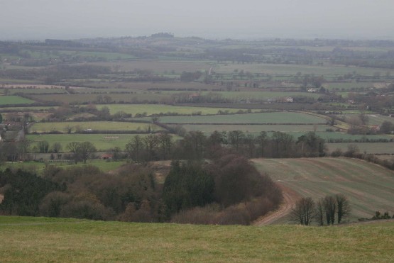
This landscape type extends from the vale landscapes adjacent to the northern part of the River Cherwell to the Upper Thames area south of Bicester. It also occupies a large part of the Vale of White Horse to the north-east of Wantage and borders part of the River Thame and its tributaries.

Overview

This is a low-lying vale landscape associated with small pasture fields, many watercourses and hedgerow trees and well defined nucleated villages.

Key characteristics
  • A flat, low-lying landform.
  • Mixed land uses, dominated by pastureland, with small to medium-sized hedged fields.
  • Many mature oak, ash and willow hedgerow trees.
  • Dense, tree-lined streams and ditches dominated by pollarded willows and poplars.
  • Small to medium-sized nucleated villages.

  • Copyright Oxfordshire County Council 2004
  • www.oxfordshire.gov.uk
  • Access keys
  • Site map
  • Credits