skip to main content | skip to access keys link
Oxfordshire Wildlife & Landscape Study
  • Joint Character Areas
  • Regional Character Areas
  • Landscape Types
  • Biomap
  • Biolandscape
  • Districts
  • Priority Habitats
Breadcrumb Location > Home > Landscape Types > Terrace Farmland
contact contact   help help 

Landscape Types:

Terrace Farmland Introduction

Select a landscape type:
  • Back to Overview Map 
  • Alluvial Lowlands
  • Chalk Downland & Slopes
  • Clay Vale
  • Estate Farmlands
  • Farmland Hills
  • Farmland Plateau
  • Farmland Slopes & Valley Sides
  • Lowland Village Farmlands
  • Pasture Hills
  • River Meadowlands
  • Rolling Clayland
  • Rolling Farmland
  • Rolling Village Pastures
  • Settled Ancient Pastures
  • Terrace Farmland
  • Upstanding Village Farmlands
  • Vale Farmland
  • Wooded Downlands
  • Wooded Estatelands
  • Wooded Estate Slopes & Valley Sides
  • Wooded Farmland
  • Wooded Hills
  • Wooded Pasture Valleys & Slopes
  • Wooded Plateau
View Detailed Information
View Map
Aerial View
Alluvial Lowlands
Chalk Downland & Slopes
Clay Vale
Estate Farmlands
Farmland Hills
Farmland Plateau
Farmland Slopes & Valley Sides
Lowland Village Farmlands
Pasture Hills
River Meadowlands
Terrace Farmland

15. TERRACE FARMLAND

Regional character areas

Upper Thames Vale, Vale of Aylesbury, Vale of White Horse and Chilterns.

Location

This landscape type extends over the terraces of the River Thames and its tributaries, covering a large expanse around Wallingford and Dorchester. It also includes the terraces of the River Thame.

Overview

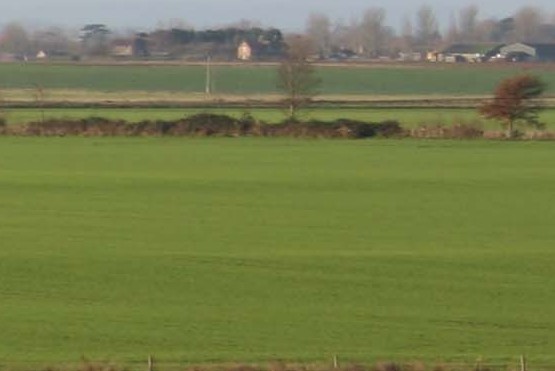
A flat, open, intensively farmed landscape overlying river gravel terraces.

Key characteristics
  • Broad, flat or low-lying gravel terraces.
  • A large scale, regularly shaped field pattern of predominantly arable land.
  • Localised tree-lined ditches.
  • Nucleated villages.

  • Copyright Oxfordshire County Council 2004
  • www.oxfordshire.gov.uk
  • Access keys
  • Site map
  • Credits