Landscape Types:
Lowland Village Farmlands
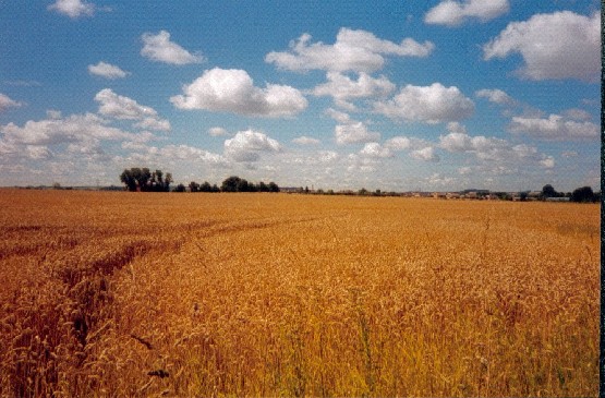
8. LOWLAND VILLAGE FARMLANDS
Regional Character Areas
Upper Thames Vale, Corallian Ridge, Vale of White Horse.
Location
The largest part of the landscape type is at the western end of the Upper Thames Vale and to the south of Witney and Carterton. A large part also falls within the clay vale area to the northwest and southwest of Didcot. Outliers of the landscape type at Islip, Merton, Charlton-on-Otmoor, Garsington and Toot-Baldon are associated with outcrops of the Corallian beds over the clay vale.
Overview
A variable, often large-scale farmed landscape closely associated with village settlements.
Key characteristics
• A varied gently rolling and almost flat topography.
• Medium to large-sized arable and hedged fields.
• Thinly scattered hedgerow trees, which are mostly ash.
• Ash, willow and poplars fringing ditches and streams.
• Prominent village settlements scattered throughout the area.
Geology and landform
Oxford Clay dominates the northwestern part of the landscape type, and this is reflected by the gently rolling, almost flat topography and in the large number of ditches and streams that drain the area. In the east, there are areas with a more rolling landform associated with the underlying Corallian beds of mixed sand and limestone. The prominent ridges at Merton and Charlton-on-Otmoor are formed by the Corallian beds overlying the Oxford Clay. To the north and south of Didcot the geology is mainly associated with the Gault Clay. However, in this area, a band of siltstones and sandy limestones of the Upper Greensand forms the transition between the low-lying Vale and the higher Downs, resulting in a more rolling landform.
Land use and vegetation
This landscape type is dominated by arable farming with some semi-improved, neutral and wet grassland around villages and bordering ditches and small streams. Small pasture fields are particularly characteristic of the undulating landscape around Toot Baldon, Garsington and to the south of Wheatley. A key landscape feature is the dense corridors of ash, willows that are often pollarded, and poplar that border watercourses.
Woodland is generally not a characteristic feature of this landscape type, except for occasional small deciduous and mixed plantations and large blocks of ancient woodland on the hilltops and slopes to the south of Ducklington. There are also small tree clumps throughout the area, particularly around villages, farmhouses and in some fields. They consist mainly of ash, willow and poplar. Poplar shelterbelts occur around Cote, Begbroke and Harwell, and a few orchards survive to the west of Harwell. Close to Stanton Harcourt and Cassington there are a number of flooded gravel pits fringed by poplars, willows and scrub.
Cultural pattern
The field pattern is largely characterised by regular, medium and large-sized arable fields with some smaller grass fields. Around the villages of Lew and Toot-Baldon and to the south of Wheatley, the grass fields are less regular in shape. Hedges are dominated by hawthorn, blackthorn and elm, and they are particularly prominent along roadsides, country lanes and areas where grassland predominates. This pattern of hedged fields is a distinctive feature of the landscape type, although it is not always obvious where it is flat. Hedgerow trees are generally sparse, with ash as the dominant tree species along with willow, poplar and dead elm. Hedgerow trees are denser within roadside hedges and next to ditches where they border pastureland, where they create filtered and framed views.
The settlement pattern is a key feature of this landscape type and it is characterised by small to medium-sized rural villages and dispersed farms bordering roads in the wider countryside. Most villages are linear in shape but a few, such as Islip and Marcham, are more nucleated with a central core of older buildings. Although there has been some new development, the vernacular character is strong in most villages, particularly within the Upper Thames Vale. The church on the ridge at Charlton-on-Otmoor is a prominent feature. The vernacular character in some of the villages within the Vale of White Horse has been a bit overwhelmed by more recent residential development. The building materials that are most widely used across the Upper Thames Vale are limestone and stone tiles, with some thatched houses at Sutton and Stanton Harcourt. In villages such as Charlton-on-Otmoor, Merton, Garsington, Toot Balton and Marcham, the main materials are stone with clay tiles or thatched roofs. Further to the south, in the Vale of the White Horse, the buildings are dominated by brick and clay tiles and some older buildings are timber framed with clay tiles or thatched roofs. In the small villages of Ardington and West Hendred, red and blue bricks with clay tiles are characteristic.
In areas such as Stanton Harcourt and Cassington, gravel extraction resulting in a number of flooded pits has had a localised impact on the landscape.
BIODIVERSITY
Overview
This is a low-lying, flat to undulating landscape dominated by arable farming and a pattern of hawthorn hedges and scattered trees. It supports a range of locally important habitats, as well as some ancient semi-natural woodland, species-rich hedges and unimproved neutral grassland.
Key Characteristics
• Predominantly low to low-medium bioscores, but in a few areas becoming medium-high.
• Important and priority habitats include ancient semi-natural woodland, species-rich hedges with trees, some neutral and wet grassland and species-rich watercourses.
General Description
This is a fairly large landscape type, occupying around 5.5% of the rural county. Although it is largely dominated by arable farming, it stills supports a range of locally important habitats including deciduous woodland, plantations, semi-improved grassland, species-poor hedges with trees and tree-lined watercourses. There are also some ancient semi-natural woodlands, parkland, species-rich hedgerows and neutral and wet grassland. Parts of the landscape type are associated with mineral extraction, and this has resulted in a number of flooded gravel pits which are particularly important for the wintering wildfowl and other bird species they attract.
LOCAL CHARACTER AREAS
Landscape Character
The area is characterized by medium-sized arable fields, and there is some semi-improved grassland in the vicinity of Little Faringdon. The unifying landscape element throughout is a network of hawthorn and elm hedges. There are a few hedgerow trees of mature oak and ash, which are more prominent around Little Faringdon. Small woodland copses of ash, willow and hawthorn are locally characteristic around the villages and at field corners next to roadside hedges. Hedges are generally low and gappy.
Biodiversity
Bioscore/bioband: 47/LM
This area supports a limited range of locally important habitats including deciduous woodland, semi-improved grassland, species-poor hedges with trees and some scattered scrub, as well as some species-poor flooded gravel pits that are used for angling.
Landscape Character
The landscape is dominated by medium to large-sized arable fields. There are some smaller, less regularly-shaped ridge and furrow fields around the village of Lew, and towards the west of the area the small fields of semi-improved and neutral grassland are drained by ditches and streams. In the eastern, more undulating part of the area, there are large blocks of ancient woodland on the hilltops and slopes, although they are not all that visually prominent. A number of smaller woods, including deciduous plantations and remnants of ancient woodland, also occur to the east of Brize Norton. Hedgerow trees, mostly oak and ash, are sparse and not a strong landscape feature. They are almost absent to the east of Yelford and northeast of Bampton. They are more prominent in hedges bordering ditches and streams, and consist mainly of ash, willow and dead elm. Dense corridors of willow, poplar and dead elm also border ditches and small streams to the east of the area. The parkland at Cokethorpe Park is surrounded by large ancient woods, and this adds to the woodland cover in this area. Apart from some gappy internal field boundaries, most fields are enclosed by low, intact hawthorn, blackthorn and elm hedges.
Biodiversity
Bioscore/bioband: 102/MH
The area supports a range of locally important habitats including deciduous woodland, plantations, semi-improved grassland, species-poor hedges with trees and tree-lined watercourses. There are a number of ancient semi-natural woodlands, which are outliers of the Royal Forest of Wychwood including Moulden’s, Barleypark, Boys and Home woods to the west of Ducklington. They are all around 30 ha and in favourable management and condition. Nearby, at Cokethorpe School, there is some parkland habitat with mature trees. Around Lew and Alvescot there are surviving areas of wet and unimproved neutral grassland.
Landscape Character
The area is dominated by medium to large-sized arable fields with pockets of smaller grass fields, streams and ditches to the south of Alvescot and Bampton, including some ridge and furrow. A network of thorn and elm hedges is the unifying element throughout the landscape. Occasionally hedges are species-rich where they enclose pastureland. Scattered hedgerow trees of ash, willow and occasionally field maple are also characteristic of the area, and are generally denser in hedges that border ditches. There are a few small poplar and deciduous plantations of field maple, willows, poplar and sycamore surrounding villages. Hedges are low and gappy in the more intensively managed arable areas, and taller and thicker where they enclose pastureland.
Biodiversity
Bioscore/bioband: 70/M
Locally important habitats include plantations, semi-improved grassland, species-poor hedges with trees and tree-lined watercourses. Priority habitats include species-rich hedges with trees and species-rich watercourses.
Landscape Character
The landscape is dominated by large arable fields, particularly to the south of Aston, although there are a small number of grass fields to the north of the area. Fields are enclosed by hawthorn and elm hedges, which are tall and in good condition to the north of the village but lower and gappier to the south. Similarly, hedgerow trees mostly of ash and dead elm are denser to the north of Aston but absent from the south.
Biodiversity
Bioscore/bioband: 20/L
This area only has a limited range of locally important habitats including species-poor hedges with trees.
Landscape Character
Large, geometrically-shaped arable fields are very prominent in this open landscape, and there is only a small amount of grassland. Fields are enclosed by very low and fragmented hedges of hawthorn and elder, which are taller where they border the occasional ditch. There are no hedgerow trees apart from some willow, ash and dead elm in the hedges bordering ditches. There are a few linear mixed plantations and poplar shelterbelts on roadsides and around farmhouses, and these have a localised visual impact.
Biodiversity
Bioscore/bioband: 35/LM
Locally important habitats include plantations, semi-improved grassland and species-poor hedges with trees. There is an old flooded gravel pit to the east of the village.
Landscape Character
The area is dominated by medium to large-sized arable fields with only a few smaller grass fields and pony paddocks surrounding the villages. Fields are enclosed by a prominent network of tall, thick hedges dominated by blackthorn, hawthorn, and goat willow, particularly along green lanes and roads. Many of these roadside hedgerows also have ash, field maple, willow and sycamore trees. There are also significant numbers of ash, sycamore, willows and poplars planted around the villages and flooded gravel pits which fall within the area.
Biodiversity
Bioscore/bioband: 41/LM
There are a few locally important habitats including semi-improved grassland and species-poor hedges with trees. There is a flooded gravel pit to the northwest of the village, which has some ornithological interest.
Landscape Character
There is a mix of land uses with medium to large-sized arable fields predominating. Smaller, semi-improved grass fields are mainly located to the north of Eynsham and south of Stanton Harcourt, particularly around restored flooded gravel pits. Semi-improved grassland is also associated with land bordering ditches and streams. Fields are enclosed by elm, hawthorn, ash and elder hedges, which are generally low, and in some places completely absent. However, they are frequently tall and thick, particularly where they border pastureland and roadsides to the south of Stanton Harcourt and in areas dominated by gravel extraction. Hedgerow trees, mostly ash, are generally sparse except where they border pastureland. In places, dense corridors of ash and willow border ditches and form a dominant landscape feature. There is a mix of coniferous, willow and poplar plantations and scrub surrounding the flooded gravel pits, large landfill site and industrial units, which are dominant visual features in this area.
Biodiversity
Bioscore/bioband: 108/MH
This area supports a range of locally important habitats including plantations, semi-improved grassland, species-poor hedges with trees and tree-lined watercourses. Other important habitats include the flooded gravel pits such as Dix Pit, which is particularly notable for its bird interest throughout the year, and some species-poor wet grassland.
Landscape Character
Medium to large-sized arable fields are characteristic of this area, although there is some grassland and pony paddocks. Fields are enclosed by prominent tall, thick hedges dominated by hawthorn, elm and blackthorn, but they tend to be lower where they surround large arable fields. Densely scattered hedgerow trees of ash, dead elm and some oak are also a key landscape feature throughout. Ash, willow and elder scrub surrounds some of the gravel pits, and there is a corridor of hawthorn, elder and ash bordering the railway line.
Biodiversity
Bioscore/bioband: 58/LM
Locally important habitats in this area include semi-improved grassland, species-poor hedges with trees and scrub. Old gravel pits to the east and south of the village are of ornithological interest, particularly the latter which is dominated by fringing reedbeds.
Landscape Character
The area is characterized by medium-sized arable fields enclosed by prominent poplar shelterbelts and tall, thick hedges dominated by elm, hawthorn with some hazel and field maple. Scattered hedgerow trees of ash, oak and some field maple are found throughout the area, and a dense corridor of willows borders Rowell Brook.
Biodiversity
Bioscore/bioband: 48/LM
Apart from locally important habitats such as species-poor hedges with trees and tree-lined water courses, the most important habitats are areas of wet grassland to the north of Kidlington and unimproved alluvial meadows lying adjacent to the Oxford Canal.
Landscape Character
The area is dominated by large arable fields enclosed by hawthorn hedges, which are generally in good condition. There are few hedgerow trees and the only obvious features are the small clumps of willow and poplar in the fields.
Biodiversity
Bioscore/bioband: 29/L
This area supports a limited range of habitats including semi-improved grassland, species-poor hedges with trees and tree-lined watercourses.
Landscape Character
The landscape is largely characterised by small-sized grass fields enclosed by hawthorn hedges, which are generally in good condition. However, some of the internal hedges are low, fragmented and often replaced by fences. Hedgerow trees, mainly ash, willow and oak, are sparse and the small ash, willow, poplar and oak plantations around the houses are characteristic.
Biodiversity
Bioscore/bioband: 14/L
This area has a limited range of locally important habitats including plantations and species-poor hedges with trees.
Landscape Character
The area is characterised by large arable fields and a few grass fields enclosed by hawthorn, blackthorn and elm hedges. These tend to be taller along roadsides and where they surround pastureland, but lower and more fragmented where they enclose arable land. Hedgerow trees of ash, crack willow, oak and dead elm are thinly scattered throughout.
Biodiversity
Bioscore/bioband: 34/LM
Locally important habitats include semi-improved grassland and species-poor hedges with trees, and there is some neutral grassland.
M. Garsington to Toot Baldon (CR/22)
Landscape Character
The area is characterised by a pattern of small, slightly irregular, semi-improved grass fields, enclosed by a prominent network of dense, tall, hawthorn and elm hedges with scattered hedgerow trees of oak, sycamore, dead elm and some ash and willow. Hedges are generally in good condition but are gappier around Garsington.
Biodiversity
Bioscore/bioband: 24/L
Locally important habitats include semi-improved grassland and species-poor hedges with trees. There is a little neutral grassland.
Landscape Character
The area is characterised by medium to large-sized arable fields with some unimproved grassland adjacent to Sandford Brook. Fields are enclosed by tall, dense hedges of hawthorn and elm. They are particularly prominent along roadsides, but internal field boundaries tend to be lower and gappier. Hedgerow trees of oak and elm are also a prominent feature within roadside hedges. Another characteristic feature is the dense corridors of pollarded willows, ash and poplar bordering Sandford Brook and other watercourses. There are a few small deciduous and mixed plantations.
Biodiversity
Bioscore/bioband: 53/LM
There are several locally important habitats including plantations, species-poor hedges with trees and tree-lined watercourses. The most important priority habitat is an area of fen and wet woodland to the east of the village.
Landscape Character
The area is characterised by medium to large-sized arable and grass fields. To the east of the village and north of Didcot Power Station, the landscape is dominated by an extensive area of mineral extraction and landfill sites, which are at varying stages of restoration. Fields are generally enclosed by a prominent network of tall, thick hawthorn and blackthorn hedges with a dense pattern of ash, willow, poplar, dead elm and oak trees, particularly bordering roads and country lanes. Roadside hedges are generally intact, but many internal field hedges are fragmented and gappy, particularly where they enclose arable land. There is also a significant number of tree-lined ditches with species such as crack willow, ash, poplar and dead elm. Small deciduous plantations and trees within villages are also characteristic.
Biodiversity
Bioscore/bioband: 63/M
There is a range of locally important habitats including plantations, semi-improved grassland, species-poor hedges with trees, scrub and tree-lined watercourses. There are a few species-rich hedges with trees.
Landscape Character
The landscape is dominated by large open arable fields with some smaller grass fields around East and West Hagbourne and Ardington. To the west of Harwell there are a few surviving orchards. Shelterbelts of poplar and avenues of sycamore, beech, poplar and ash bordering many roads are a characteristic feature of this area. Small broadleaved plantations around Ardington and trees surrounding farms are locally characteristic. Corridors of ash, willow and poplars border Ardington and East Hendred brooks, and they are locally prominent landscape features. Hawthorn and elm hedges have been removed in many places, and are frequently gappy where they still survive. They are more intact along roadsides.
Biodiversity
Bioscore/bioband: 58/LM
This area supports a range of locally important habitats including plantations, deciduous woodland, semi-improved grassland, species-poor hedges with trees, scrub and tree-lined watercourses. The only other notable habitat recorded is parkland with associated mature trees and lakes at Ardington.
Landscape Character
The area is dominated by large arable fields with a few pony paddocks around Cholsey. They are enclosed by gappy hawthorn and elm hedges which, in some places, have been removed altogether. Hedgerow trees consisting mainly of ash, elm and dead elm are sparse throughout. Clumps of sycamore, willow and ash surrounding farms, houses and the hospital are notable features.
Biodiversity
Bioscore/bioband: 28/L
This area has only a limited range of locally important habitats including semi-improved grassland, species-poor hedges with trees and some tree-lined watercourses.
FORCES FOR CHANGE
• Overall, the field pattern is in good condition, particularly roadside hedges which can be very dense, tall and intact, and also where they enclose pastureland. However, in areas of intensively managed arable land, the internal field hedges are often very low, fragmented and in some cases removed altogether, resulting in an open landscape. This weakening of the landscape structure exacerbates the intrusion of built development and roads.
• Although the vernacular character is generally strong in the villages, most of them have varying amounts of modern residential development. In some villages, such as Harwell, East and West Hagbourne, there is a significant proportion of modern housing. Ribbon development is also a feature along main roads such as the A417, and urban fringe development is more noticeable around main towns such as Didcot.
• Large-scale agricultural barns can also be visually dominant, particularly when located on roadsides.
• Motorways and main roads such as the A4130 and A417, with their associated junctions and roundabouts, have a major impact, particularly in the area around Didcot. Along the A34, landscaping and tree planting helps to mitigate the impact of continuous traffic.
• Large-scale industrial estates, such as those to the north of Brighthampton and south of Eynsham, have a strong negative visual impact, particularly in open areas with a weak or fragmented landscape structure.
• Didcot power station is visually prominent throughout the whole area.
• Gravel extraction and major landfill sites to the south of Stanton Harcourt and east of Sutton Courtenay have a significant impact on the landscape, but this is mitigated to some extent by screen planting and landscaping.
• Brize Norton airfield and its associated premises are very visible, particularly where the field pattern is weak.
Landscape Strategy
Conserve and enhance the vernacular character of the villages and strengthen the existing pattern of hedgerows, hedgerow trees and tree-lined watercourses.
Guidelines
• Strengthen the field pattern by planting up gappy hedges using locally characteristic species such as hawthorn, and hedgerow trees such as willow and ash.
• Promote environmentally-sensitive maintenance of hedgerows, including coppicing and layering when necessary, to maintain a height and width appropriate to the landscape type.
• Enhance and strengthen the character of tree-lined watercourses by planting willows and ash and where appropriate, pollarding willows.
• Conserve the surviving areas of permanent pasture and promote arable reversion to grassland, particularly on land adjacent to watercourses.
• Minimise the visual impact of intrusive land uses, such as industrial estates, gravel pits, landfill sites, airfields and the fringes of towns and villages with the judicious planting of tree and shrub species characteristic of the area. This will help to screen the development and integrate it more successfully with its surrounding countryside.
• Maintain the vernacular character of settlements and promote the use of local building materials and a scale of development and that is appropriate to this landscape type. This ranges from limestone and stone tiles at Garsington and Merton through to the red bricks and tiles associated with the clay vales.
Biodiversity Strategy
Ensure that all surviving priority habitats are safeguarded, in favourable condition and management, and enhanced to satisfy the actions and targets identified within the relevant habitat and species action plans. Safeguard, maintain and enhance all locally important habitats in a way that is appropriate to the landscape character of the area. Promote agri-environment schemes which will benefit biodiversity in general and protected species and farmland birds in particular.
Guidelines
• Priority habitats in this landscape type are relatively small and isolated. They include some species-rich neutral grassland, fen and species-rich hedgerows.
• The species-rich neutral grassland and fen sites are S.S.S.I.s and the priority is to ensure that they are in favourable condition and management through formal agreement between the landowner and English Nature. Opportunities for successfully expanding this habitat type are limited.
• Species-rich hedgerows are distributed throughout different parts of the landscape type. Priority should be given to safeguarding, maintaining and expanding this resource, particularly in those local character areas where they remain a significant feature.
• There are a number of ancient semi-natural woodland within the landscape type, and several have been designated as county wildlife sites. The priority must be to ensure that all these sites are in favourable condition and management.
• There are a few flooded gravel pits which are of ornithological importance, such as Dix and Cassington pits, and priority must be given to safeguarding and enhancing this interest.
• Tree-lined watercourses are a feature throughout the landscape type. They should be safeguarded and enhanced by planting species such as ash and willows, pollarding willows where appropriate, and establishing buffer strips/field margins to potentially benefit small mammals, invertebrates and birds.
• Opportunities for the establishment of other locally important habitats, such as semi-improved grassland and small deciduous woodlands, should be promoted in a way to strengthen wildlife corridors and enhance the local landscape character.
• Promote the use of agri-environment schemes such as conservation headlands, over-wintered stubbles, and winter-sown crops to benefit farmland birds such as skylarks and yellowhammers.
Key Recommendations
• Safeguard and enhance the landscape character of the hedgerow network, and tree-lined watercourses.
• Ensure that all priority habitats are in favourable condition and management.