skip to main content | skip to access keys link
Oxfordshire Wildlife & Landscape Study
  • Joint Character Areas
  • Regional Character Areas
  • Landscape Types
  • Biomap
  • Biolandscape
  • Districts
  • Priority Habitats
Breadcrumb Location > Home > Landscape Types > Alluvial Lowlands
contact contact   help help 

Landscape Types:

Alluvial Lowlands Introduction

Select a landscape type:
  • Back to Overview Map 
  • Alluvial Lowlands
  • Chalk Downland & Slopes
  • Clay Vale
  • Estate Farmlands
  • Farmland Hills
  • Farmland Plateau
  • Farmland Slopes & Valley Sides
  • Lowland Village Farmlands
  • Pasture Hills
  • River Meadowlands
  • Rolling Clayland
  • Rolling Farmland
  • Rolling Village Pastures
  • Settled Ancient Pastures
  • Terrace Farmland
  • Upstanding Village Farmlands
  • Vale Farmland
  • Wooded Downlands
  • Wooded Estatelands
  • Wooded Estate Slopes & Valley Sides
  • Wooded Farmland
  • Wooded Hills
  • Wooded Pasture Valleys & Slopes
  • Wooded Plateau
View Detailed Information
View Map
Aerial View
Alluvial Lowlands
Chalk Downland & Slopes
Clay Vale
Estate Farmlands
Farmland Hills
Farmland Plateau
Farmland Slopes & Valley Sides
Lowland Village Farmlands
Pasture Hills
River Meadowlands
Alluvial Lowlands

1.   ALLUVIAL LOWLANDS

Regional character areas

Upper Thames Vale, Vale of Aylesbury, Vale of White Horse and Chilterns.

Location

This landscape type is restricted to lowland areas, associated with alluvium drifts, adjacent to the main river corridors of the upper and lower Thames, the lower Cherwell and the rivers Ray and Ock.

Overview

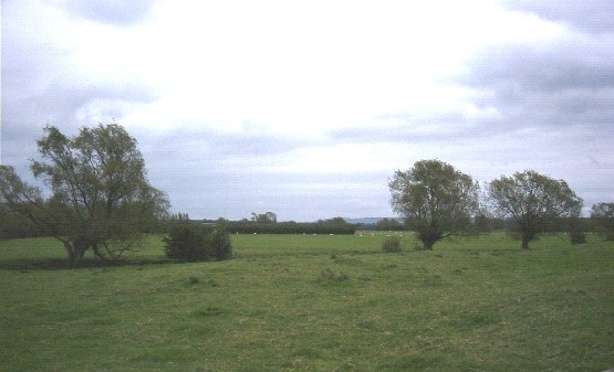
This landscape type includes flat landscapes of lowland river valleys, associated with alluvial soils. It is characterised by a regular pattern of medium-sized hedged fields with permanent pasture and arable cropping.

Key characteristics
  • Broad alluvial plains.
  • Mixed farming pattern with regular fields with both arable cropping and pasture.
  • Densely scattered hedgerow trees of ash and willow.
  • Dense willow corridors bordering a large number of ditches.
  • Sparsely settled.

  • Copyright Oxfordshire County Council 2004
  • www.oxfordshire.gov.uk
  • Access keys
  • Site map
  • Credits