skip to main content | skip to access keys link
Oxfordshire Wildlife & Landscape Study
  • Joint Character Areas
  • Regional Character Areas
  • Landscape Types
  • Biomap
  • Biolandscape
  • Districts
  • Priority Habitats
Breadcrumb Location > Home > Landscape Types > Rolling Village Pastures
contact contact   help help 

Landscape Types:

Rolling Village Pastures Introduction

Select a landscape type:
  • Back to Overview Map 
  • Alluvial Lowlands
  • Chalk Downland & Slopes
  • Clay Vale
  • Estate Farmlands
  • Farmland Hills
  • Farmland Plateau
  • Farmland Slopes & Valley Sides
  • Lowland Village Farmlands
  • Pasture Hills
  • River Meadowlands
  • Rolling Clayland
  • Rolling Farmland
  • Rolling Village Pastures
  • Settled Ancient Pastures
  • Terrace Farmland
  • Upstanding Village Farmlands
  • Vale Farmland
  • Wooded Downlands
  • Wooded Estatelands
  • Wooded Estate Slopes & Valley Sides
  • Wooded Farmland
  • Wooded Hills
  • Wooded Pasture Valleys & Slopes
  • Wooded Plateau
View Detailed Information
View Map
Aerial View
Alluvial Lowlands
Chalk Downland & Slopes
Clay Vale
Estate Farmlands
Farmland Hills
Farmland Plateau
Farmland Slopes & Valley Sides
Lowland Village Farmlands
Pasture Hills
River Meadowlands
Rolling Village Pastures

13. ROLLING VILLAGE PASTURES

Regional character areas

Northamptonshire Uplands and Cotswolds.

Location

This landscape type covers the rolling pastoral landscapes in the north of the county around Swalcliffe, Hook Norton and South Newington.

Overview

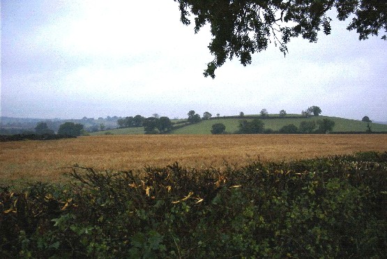
The landscape type is characterised by a distinctive landform of small rounded hills and narrow valleys. Unspoilt ironstone villages, with a strong vernacular character, form part of the tranquil countryside.

Key characteristics
  • A strongly undulating landform of rounded hills and small valleys.
  • Small to medium-sized fields with mixed land uses, but predominantly pasture.
  • Densely scattered hedgerow trees.
  • Well defined nucleated villages with little dispersal into the wider countryside.

  • Copyright Oxfordshire County Council 2004
  • www.oxfordshire.gov.uk
  • Access keys
  • Site map
  • Credits