OWLS:
Oxfordshire Wildlife & Landscape Study
 Landscape Types
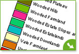
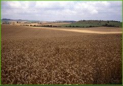
Oxfordshire is an attractive county with a variety of different landscapes and habitats. These include the Chiltern beechwoods, the limestone grasslands of the Cotswolds and the lush meadows of the Thames Valley.
This website shows the results of the Oxfordshire Wildlife and Landscape Study (OWLS) - an investigation of landscape character and biodiversity across the county. It was jointly sponsored by: Oxfordshire County Council, Natural England and The Earth Trust.
Whether you are a planner, a conservationist, a resident of Oxfordshire, or are just interested in ecology, this website is for you.
Find out more about the project
OWLS within Planning
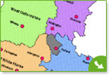
OWLS is the current landscape character assessment for Oxfordshire; it should be used in conjunction with landscape character assessments available at a district level. Visit our Archaeology pages for information on our Historic Landscape Character project, which aims to be complete in 2016.
You can download the background GIS datasets here (.zip format, 3.7Mb); the corresponding information is found under the Landscape Types tab. For smaller applications you can enter the interactive map through the District tab, use the parish search function and click on each Landscape Type (e.g. River Meadowlands). This should automatically link to text on the area-specific Local Character Areas (e.g. B. Sor Brook NU/12) and you can scroll up or down to find the broader information, guidelines and recommendations for each type.