skip to main content | skip to access keys link
Oxfordshire Wildlife & Landscape Study
  • Joint Character Areas
  • Regional Character Areas
  • Landscape Types
  • Biomap
  • Biolandscape
  • Districts
  • Priority Habitats
Breadcrumb Location > Home > Landscape Types > Wooded Pasture Valleys & Slopes
contact contact   help help 

Landscape Types:

Wooded Pasture Valleys & Slopes Introduction

Select a landscape type:
  • Back to Overview Map 
  • Alluvial Lowlands
  • Chalk Downland & Slopes
  • Clay Vale
  • Estate Farmlands
  • Farmland Hills
  • Farmland Plateau
  • Farmland Slopes & Valley Sides
  • Lowland Village Farmlands
  • Pasture Hills
  • River Meadowlands
  • Rolling Clayland
  • Rolling Farmland
  • Rolling Village Pastures
  • Settled Ancient Pastures
  • Terrace Farmland
  • Upstanding Village Farmlands
  • Vale Farmland
  • Wooded Downlands
  • Wooded Estatelands
  • Wooded Estate Slopes & Valley Sides
  • Wooded Farmland
  • Wooded Hills
  • Wooded Pasture Valleys & Slopes
  • Wooded Plateau
View Detailed Information
View Map
Aerial View
Alluvial Lowlands
Chalk Downland & Slopes
Clay Vale
Estate Farmlands
Farmland Hills
Farmland Plateau
Farmland Slopes & Valley Sides
Lowland Village Farmlands
Pasture Hills
River Meadowlands
Wooded Pasture Valleys & Slopes

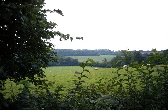
24. WOODED PASTURE VALLEYS & SLOPES

Regional Character Areas

Northamptonshire Uplands, Cotswolds and Chilterns.

Location

This landscape type extends over the steep-sided valleys in the Ironstone area around Wroxton and Shenington, the valleys of the rivers Glyme and Dorn in the Cotswolds, the tributary valleys of the River Windrush and the dry valleys to the south of the Chilterns.

Overview

This landscape type includes pastoral and wooded landscapes associated with the steep slopes and valleys of small streams and main rivers.

Key characteristics
  • Steep sided valleys and slopes.
  • Large, interlocking blocks of ancient and plantation woodland.
  • Small pasture fields with localised unimproved grassland.
  • Tall, thick hedges and densely scattered hedgerow trees.
  • Small, intact villages and hamlets.

    • Copyright Oxfordshire County Council 2004
    • www.oxfordshire.gov.uk
    • Access keys
    • Site map
    • Credits