skip to main content | skip to access keys link
Oxfordshire Wildlife & Landscape Study
  • Joint Character Areas
  • Regional Character Areas
  • Landscape Types
  • Biomap
  • Biolandscape
  • Districts
  • Priority Habitats
Breadcrumb Location > Home > Landscape Types > Farmland Hills
contact contact   help help 

Landscape Types:

Farmland Hills Introduction

Select a landscape type:
  • Back to Overview Map 
  • Alluvial Lowlands
  • Chalk Downland & Slopes
  • Clay Vale
  • Estate Farmlands
  • Farmland Hills
  • Farmland Plateau
  • Farmland Slopes & Valley Sides
  • Lowland Village Farmlands
  • Pasture Hills
  • River Meadowlands
  • Rolling Clayland
  • Rolling Farmland
  • Rolling Village Pastures
  • Settled Ancient Pastures
  • Terrace Farmland
  • Upstanding Village Farmlands
  • Vale Farmland
  • Wooded Downlands
  • Wooded Estatelands
  • Wooded Estate Slopes & Valley Sides
  • Wooded Farmland
  • Wooded Hills
  • Wooded Pasture Valleys & Slopes
  • Wooded Plateau
View Detailed Information
View Map
Aerial View
Alluvial Lowlands
Chalk Downland & Slopes
Clay Vale
Estate Farmlands
Farmland Hills
Farmland Plateau
Farmland Slopes & Valley Sides
Lowland Village Farmlands
Pasture Hills
River Meadowlands
Farmland Hills

5. FARMLAND HILLS

Regional character areas

Cotswolds, Upper Thames Vale, Corallian Ridge and Vale of White Horse.

Location

This landscape type covers the isolated farmland hills around Little Faringdon, Asthall, Woodeaton, Chiselhampton, Little Wittenham and to the north of Cholsey.

Overview

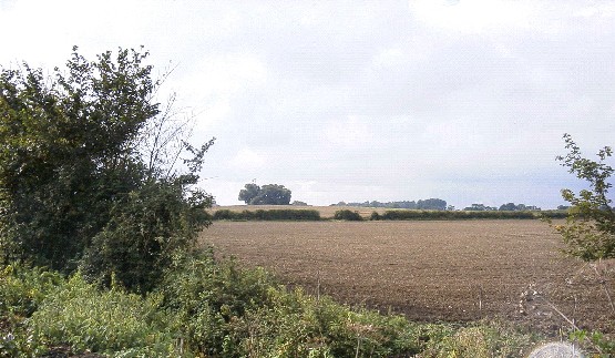
Prominent hills and ridges dominated by arable farming and interspersed with small to medium-sized woodlands and plantations.

Key characteristics
  • Large, regularly shaped arable fields enclosed by fragmented hawthorn hedges.
  • Tree clumps and blocks of semi-natural and plantation woodland.
  • Sparsely settled landscape.

  • Copyright Oxfordshire County Council 2004
  • www.oxfordshire.gov.uk
  • Access keys
  • Site map
  • Credits