| skip to main content | skip to access keys link
Oxfordshire Wildlife & Landscape Study
  • Joint Character Areas
  • Regional Character Areas
  • Landscape Types
  • Biomap
  • Biolandscape
  • Districts
  • Priority Habitats
Breadcrumb Location > Home > Districts > Districts - Parishes > South Oxfordshire
contact contact   help help 

Districts:

South Oxfordshire Parishes

Select District:
 
  • Districts - Parishes
    • Cherwell
    • South Oxfordshire
    • Vale of White Horse
    • West Oxfordshire
  • Districts - Landscape Types
South Oxfordshire Parishes
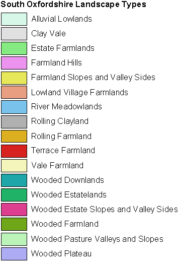
This map highlights the landscape types within the parish you selected, and its associated local character areas. You can click on any area of the map for a description of its landscape character and biodiversity. Please note that local character areas can cover large areas of the countryside, and may include several parishes, so the description may not be specific to this parish. If there are any wildlife habitats within the parish their descriptions can be found by scrolling to the bottom of this page.
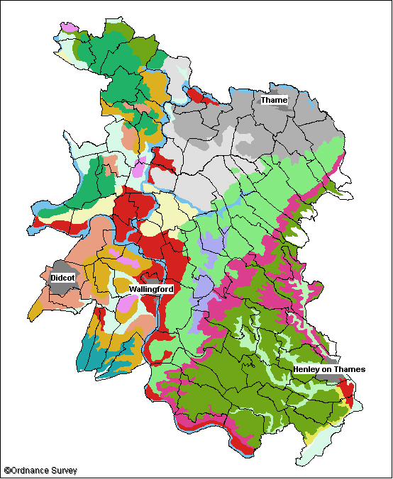
South Oxfordshire Parishes Image Map

Clay Vale B Prescote Adwell Berrick Salome Wheatfield Wheatfield Wallingford Woodeaton Cuxham with Easington Stoke Talmage Little Wittenham Waterstock Waterstock Sonning Common Berinsfield Sandford-on-Thames East Hagbourne East Hagbourne East Hagbourne Crowell West Hagbourne Dorchester Wheatley Tiddington-with-Albury Shiplake North Moreton Toot Baldon Horspath Horspath Aston Upthorpe Marsh Baldon Highmoor Drayton St. Leonard Stoke Row Stoke Row Whitchurch-on-Thames Little Milton South Moreton Towersey Towersey Towersey Towersey Henley-on-Thames Britwell Salome Nettlebed Binfield Heath Elsfield Sydenham Brightwell Baldwin Holton Warborough Woodcote Moulsford Newington Cuddesdon and Denton Forest Hill with Shotover South Stoke Aston Tirrold Rotherfield Peppard Clifton Hampden Clifton Hampden Culham Garsington Didcot Nuneham Courtenay Rotherfield Greys Harpsden Beckley and Stowood Beckley and Stowood Long Wittenham Goring Bix and Assendon Bix and Assendon Stadhampton Shirburn Benson Waterperry with Thomley Eye and Dunsden Eye and Dunsden Great Milton Pishill with Stonor Checkendon Tetsworth Kidmore End Stanton St. John Stanton St. John Ipsden Chalgrove Mapledurham Goring Heath Ewelme Aston Rowant Crowmarsh Thame Nuffield Lewknor Lewknor Brightwell-cum-Sotwell Pyrton Chinnor Swyncombe Watlington Cholsey Great Haseley Great Haseley Great Haseley

Legend


  • Copyright Oxfordshire County Council 2004
  • www.oxfordshire.gov.uk
  • Access keys
  • Site map
  • Credits