|
skip to main content
|
skip to access keys link
Joint Character Areas
Regional Character Areas
Landscape Types
Biomap
Biolandscape
Districts
Priority Habitats
Location
>
Home
>
Districts
>
Districts - Landscape Types
>
Cherwell
contact
help
Districts:
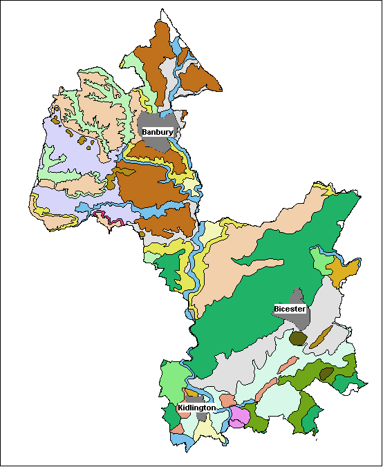
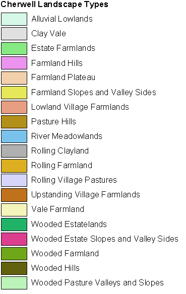
Cherwell Landscape Types
Select District:
Districts - Parishes
Districts - Landscape Types
Cherwell
South Oxfordshire
Vale of White Horse
West Oxfordshire
Cherwell Landscape Types
Select a landscape type by moving your cursor over the map and clicking.