Districts:
Cherwell Parishes
Mixbury
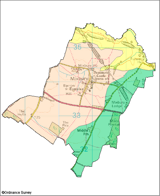
The following wildlife habitats fall within this parish. They are listed according to their associated landscape type or local character area.
If you want more information about any of the sites of special scientific interest (SSSIs) listed below, take a look at English Nature's Nature on the Map website. It may also be possible to find out a bit more about the unnamed wildlife habitats in the parish by contacting the Thames Valley Environmental Records Centre (owls@oxfordshire.gov.uk) and quoting the site code next to the habitat description.
The majority of these wildlife habitats are on private land and access to them is not possible without permission of the landowner, unless there is a statutory right of way. However, many wildlife habitats in the county are open to the public. More information on these can be obtained from the Oxfordshire Nature Conservation Forum.
Wildlife Habitats
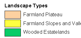
Farmland Plateau
Site Code: LIN2
Area: 8.9ha
This site consists of three sections of the a disused railway. Running through land largely used for arable crops the cuttings and embankments support areas of limestone and rough grassland along with scrub. Limestone grassland is a national priority for nature conservation.
The longer northern sections are particularly good for butterflies. The uncommon small blue and dark green fritillary are present along with dingy skipper, common blue and marbled white. Wildflowers include the tall colourful oxeye daisy, knapweeds and field scabious along with cowslip, marjoram and green-winged orchids.