Districts:
Cherwell Parishes
Wendlebury
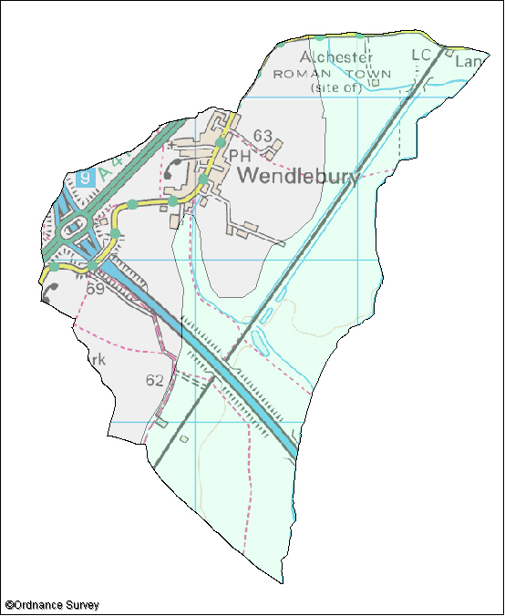
The following wildlife habitats fall within this parish. They are listed according to their associated landscape type or local character area.
If you want more information about any of the sites of special scientific interest (SSSIs) listed below, take a look at English Nature's Nature on the Map website. It may also be possible to find out a bit more about the unnamed wildlife habitats in the parish by contacting the Thames Valley Environmental Records Centre (owls@oxfordshire.gov.uk) and quoting the site code next to the habitat description.
The majority of these wildlife habitats are on private land and access to them is not possible without permission of the landowner, unless there is a statutory right of way. However, many wildlife habitats in the county are open to the public. More information on these can be obtained from the Oxfordshire Nature Conservation Forum.
Wildlife Habitats
Alluvial Lowlands
Site Code: 51U03
Area: 2.6ha
This site consists of three long narrow ponds. Two of the ponds are largely filled with bulrush and there is little open water. One pond has willows growing in the water. The largest pond has more open water and also areas of tall wetland vegetation dominated by reed grasses and some bulrush. This habitat is known as swamp because it often inundated by water.
A variety of wetland and aquatic wildflowers are present including water mint, yellow flag iris, meadowsweet and water plantain. At the edge there are areas of wet willow dominated woodland. Wet woodland and tall wet wetland habitat are national priorities for conservation.